Summary:
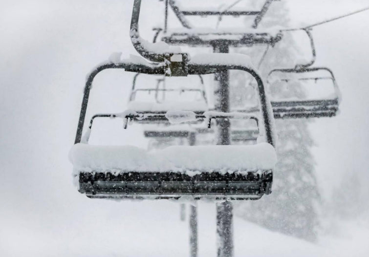
October landed record amounts of moisture in most of northern California. Resorts are opening today. Let's look at the numbers and a quick look at the extended forecast.
Storm Recap:
This week broke all-time records for moisture in some areas of California. Sacramento saw 5.44 inches of rain in 24 hours breaking a record from 1880. Very impressive moisture landed feet of base building (Wet) for the mid and upper elevations of the Sierra Range. Many base areas also saw snow, with 8-12 inches at lower elevations.
Here is a quick look at the impressive numbers of a few areas in Cali from the previous storm (These numbers recorded the 2nd snowiest October on record in some areas of the Sierra).
Mount Rose Summit: 42 inches (Summit)
Palisades at Tahoe: 39 inches (Summit)
Homewood 36 inches (Summit)
Mammoth 36 inches (Summit).
Kirkwood 20 inches at the base with no official snow report issued for mid or upper elevations.
Meanwhile, as the storm moved east it brought decent numbers to the Rockies with a general spread of 4-16 inches. Areas at the upper locations Utah resorts around Park City are now snow-covered (light-moderate snow up top), with up to 15 inches in the upper Cottonwoods in the past week. My forecast called for 11-16 inches for this last storm for the Cottonwoods so it hit the upper end of that estimate. Ski conditions on Tuesday and Wednesday were pretty deep, especially above 9,000 feet. Lower elevations had less (7-10) in the Cottonwoods.
Below: @powderchasersteve via Instagram in the Wasatch Wednesday morning (Pre-dawn hike). Conditions were riding deep (15 inches) with a bit of wind impaction and slight warming. \"Deep cushion pow\" Tuesday was lighter as it was snowing most of the day.

Meanwhile, in the Tetons 6-8 inches fell at the upper elevations of Targhee, with much less at JHMR. NW flow and perhaps slightly cooler temps may have benefited the western side of the Teton Range. Temps were also very warm initially with the SW flow so it limited precipitation on the eastern side of the Teton Range.
Finally in Colorado, decent snowfall fell as forecasted primarily on the western side of the I-70 corridor as winds veered to the NW Tuesday night. The Vail Snow Stake was up to 10 inches on Wednesday and Telluride scored around a foot (Benefits from NW flow on the northern side of the San Juan Range). Steamboat had a respectable 8 inches. Red Mountain Pass near Silverton recorded 14 inches. Further east in Colorado 3-5 inches fell in Summit County. These numbers were very close to the original forecast that favored the western corridor.
Below: Vail Pass Tuesday night (Dumping).

New Openings: Woo Hoo- October scores.
Palisades at Tahoe (3rd time in 72 years they have opened in October). -Today -October 29th
Boreal Mountain- Today- October 29th
Loveland -Opens Saturday, October 30th
As more Ski Areas continue to open we can actually start talking about legitimate chases on the forecast. Let's look at the extended outlook where some snow is possible next week.
Short and extended forecast:
A cold front will sweep into the southern Interior of BC and northern Montana today (Friday) and Saturday. This will keep moderate snowfall limited to Glaciar National Park (Eastern side) and the mountain passes of northern Montana.
That cold front will sweep south early next week and kick off snow showers over central Wyoming and most of northern Colorado. the models are not in agreement for snow totals for Colorado, however. Winds are from the SW initially next week (Not favorable for heavy snow in northern Colorado) veering NW by late Tuesday night (More favorable). The American model keeps light snowfall confined to northern Colorado (2-6) with the European model showing a chance of moderate snow especially Wednesday morning. The Canadian is also somewhat optimistic similar to the European. Therefore, my forecast will go with light snow showers confined to the northern Colorado mountains (I-70 and north) early next week with a 50% chance of moderate snowfall (6-10) by Wednesday morning (Snow total from Monday to Wednesday peaking Wed morning). Wednesday could be a powder day if we get lucky up north.
Below: European Model is the most optimistic for up to 10 inches by midweek at the summits of the northern Colorado mountains (North of I-70 are favored). Maybe Steamboat scores?

Below: The GFS is less optimistic showing less snow. Boo Hoo

Looking out to the end of next week (November 4th timeframe) a stronger cold front might arrive in the Pacific Northwest bringing a chance of snow to the Cascades late next week. This will migrate over the northern Rockies at some point during next weekend or beyond. This system seems to favor Oregon, Washington, Idaho, Montana, and Wyoming, but it's too far out to put much confidence in it just yet.
Below: Decent cold front late next week over the PNW.

Below: Low pressure entering the far west by Friday next week

Enjoy the new Ski Area openings, everyone! Follow me on Instagram @powerchasersteve for my latest adventures in photography and travel.
ANNOUNCEMENT: SHREDFEST music and winter festival returns to Salt Lake City next week November 5th and 6th. Live Bands, Ski Films, Rail Jams, and a ton of fun. Tickets can be purchased in advance here. Powderchasers will have a booth set up so come and visit for some free stuff and a chance to win some Concierge packages. This has been a great event (Bands, films and fun).


