
Summary:
As of 8 PM Thursday, Colorado is scoring powder west of the Continental Divide with up to 8 inches at Beaver Creek at press time. This teaser storm may also impact areas near Taos (3-5"), though some models look overconfident. The biggest news in this post is for Canada and the PNW, where feet will fall.
A deep low-pressure system dropping out of the Gulf of Alaska has tapped an atmospheric river aimed at the Pacific Northwest and British Columbia, with some mountains likely to see 2–3 feet before the storm exits. The Northern Rockies remain active, picking up the remnants with up to 12 inches, while Colorado finally enters the mix, with areas along the Divide seeing up to 8 inches.
Expected Snow Totals:
Mt. Baker Ski Area: 10-14"
Stevens Pass: 7-11"
Crystal: 12-16"
Timberline: 10-15"
Alpental at Snoqualmie: 8-12"
Whistler: 18-24"
Powder Mtn Heli: 10-16"
Big White: 6-12"
Revy: 5-10"
Steamboat: 2-4"
Beaver Creek: 6-8"
Vail: 3-5"
Aspen: 3-6"
Loveland: 3-8"
Tetons: 8-14"
Cottonwoods-Utah: 2-6"
Park City: 1-3"
Bridger: 1-3"
Whitefish: 2-4"
Big sky: 4-6"
Brundage: 10-15"
Tamarack: 8-10"
Sun Valley: 4-8"
Taos: 3-5"
Palisades Tahoe: 1-3"
Thursday night (10/23) - Saturday morning (10/25):
__________________________________________________
The first part of the storm is driven by the atmospheric river, which supplies most of the moisture, especially in the PNW and B.C.
The heaviest snow should fall Friday into Saturday, with Whistler in the bullseye at 2+ feet for the mid–upper mountain. Interior B.C. and Alberta should get 7-14". The Cascades are also well-positioned: Crystal (WA) around a foot, and Timberline (OR) roughly a foot at lodge level and up to 2 feet at higher elevations. Mt Baker is also favored with 12 plus inches.
Below: Total snowfall model for the PNW + British Columbia.
The neon purple/white zones indicate 20" + for coastal British Columbia, while the bright Pink indicates around 12" for most of Oregon and Washington.

Below: The model panel highlights the AR plume, with darker reds/browns corresponding to ~6 inches of liquid-equivalent (QPF) along coastal B.C. and nearly 4 inches across higher terrain in Washington. As the low-pressure system moves down towards the PNW, you can see the precipitation labeled in red starts to increase, forming the atmospheric river.

ROCKIES:
Saturday night (10/25) - Tuesday morning (10/28):
________________________________________________
By Saturday night, snow will spread into the Northern Rockies, Idaho, Montana, and Wyoming, and continue through early Tuesday. Snow levels will be low across all ski areas with this storm, with snow to the bases and valleys. Western Idaho will be the first to see snow Saturday evening, with Brundage and Tamarack favored to receive 12 inches or more.
Montana's snow arrives near midnight Saturday with light to moderate totals of 3–6 inches at many ski areas. In the Tetons, expect 10–14 inches above 8,000 feet, with the heaviest snowfall from Sunday into Monday. For Utah, expect light to moderate totals in the 3-6 inch range with snow levels around 6,000ft. Finally, after a small low-pressure system hits Colorado on Friday, dropping 1–3 inches, another push arrives Monday with around 3 inches, bringing storm totals to 5–8 inches. Snow levels in Colorado should sit near 9,000 ft on Friday and 10,200 ft with Monday's push, meaning accumulation will occur on mountain passes.
Below: Snow total Map For ID, MT, WY, UT.
The model below shows moderate accumulation Thursday-Friday in Colorado, followed by the main low-pressure system off the coast of the PNW, which brings moderate to heavy snow to the Northern Rockies this weekend. Map Range: Thursday(10/23) -Tuesday(10/28).

Colorado: Thursday-Friday - Snow is falling currently at press time.
___________________________________________
Colorado is set to see its first moderate storm of the winter, with precipitation fueled by a weak low-pressure system tracking through the Four Corners into the state. As shown in the model below, the Four Corners system (light blue) arrives Thursday night into Friday, while the main low (green/purple) delivers a second wave Sunday night into Monday. Resorts along and just west of the Continental Divide can expect 3–6", with potential for ~8" atop Vail Pass by this Friday morning (Storm #1).

Below: Beaver Creek has 8 inches as of 8 PM Thursday!

Extended:
_______________________
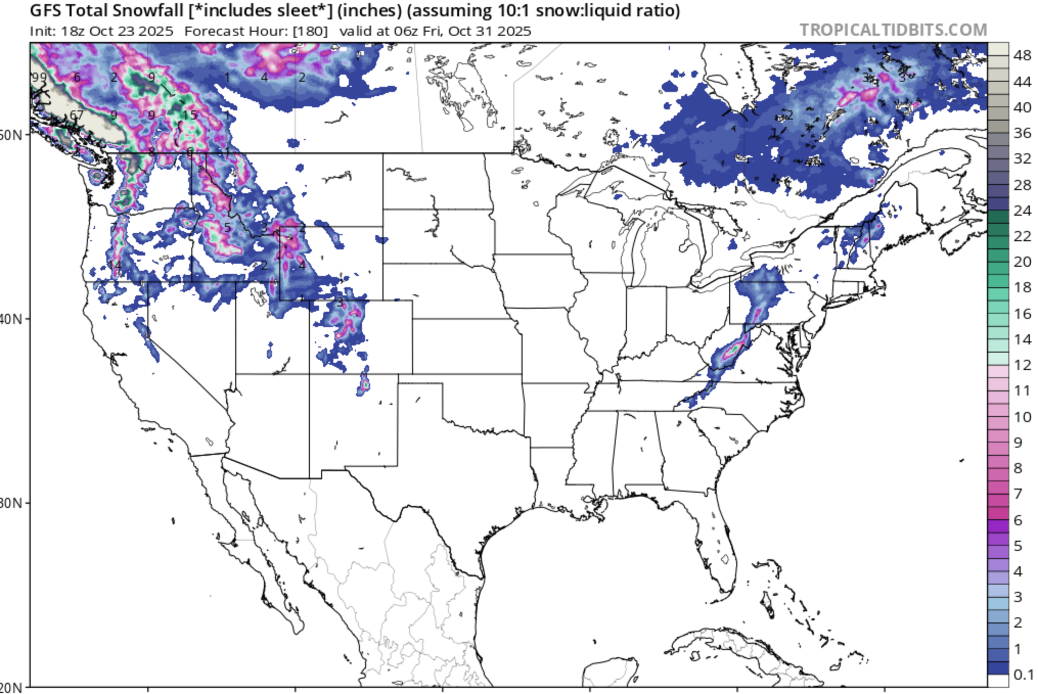
For the U.S., things are quiet until Halloween. However, Canada is set to see moderate to heavy snow across coastal and interior B.C. Tuesday- Friday.
Announcement: This is the final 10 days to purchase our Concierge (Custom chase forecasts and trip planning) at a significant discount. The discount ends on October 31st.
Please support Powderchasers' free powder forecasts with a donation here or join our concierge program while it is on sale through October. 
Forecaster: Mark Mazzatta


