Summary:
If you were lucky, you would have been in the Pacific Northwest on Monday. High pressure is taking hold over the west with a few weak storms for Colorado and New Mexico. Mid month pattern change is likely
Forecast:
One nice thing about being a Powder Forecaster is that snow is in our forecasts nearly every post. Yesterday we chased last minute to Washington and with a 3:30 AM wake-up call, and a long drive from Seattle ended up at Mt. Baker Ski Area. Would have been nice to stay at Mt. Baker Lodging and sleep in. Snow began at 4 AM and only measured 3 inches by 6 AM. Looking at the short-term high-resolution models there was a good chance of an additional 9 inches during the day. Further south the models were less optimistic. By 9 AM (Opening) conditions were good (6-8 upper mountain), drier at higher elevations, denser down low. By 11 AM conditions were full-on deep, with medium density snow (Temps cooled with the cold front). Chases are often last minute, and not without changes. We scored best day of the season thus far just as high pressure is settling in for many areas of the West. If you want to score deep powder join our Concierge Program and follow along with our team.
Below:@powderchasersteve Mt. Baker Ski Area Monday morning. Thats the biggest plow I have seen! I think Snowbasin has a similar one. @powderchasersteve via Instagram

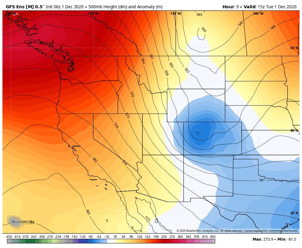
Currently, light snow is falling over the western mountains of Colorado. Models show periodic snow showers that could persist into Wednesday (2-5) The highest amounts are likely along or north of I-70. Some higher peaks of Colorado may score upwards of 5 inches (Vail, Steamboat, Breckenridge) by Wednesday morning.
Below: Weak trough over Colorado currently spreading snowfall west of the Divide.

Let's move onto the long-term outlook.
Extended:
The goal is to look for deep snow! Currently, the Jet Stream is favored to keep storms pushed north over a ridge in the west. Another Trough will enter Canada by the upcoming weekend pushing some moisture into the Cascases of Washington. Western BC seems to be favored with this storm. The Cascades are worth watching for perhaps a moderate event.
The pattern shows little change into next week with additional moderate systems likely for BC and perhaps northern Washington (Wildcard). Interior BC might uptick on amounts next week as well. The Canadian locals are all getting rewarded this season \"big time\"
The good news is that by December 9th the pattern begins to shift south with an increasing chance of some snowfall for the Rockies. This pattern will continue to develop into a more confident forecast for more areas of the west to grab some snowfall (December 12-14). While confidence this far out is never high, the models seem to bring signals of a 4 corners low setting up at some point mid-month. I won't share the long term deterministic models just yet, but once we extend beyond mid- December it's possible the Sierra and many areas of the Rockies are grabbing freshies once again.
Below: Ensembles showing a return of low pressure as early as December 12th with a low setting up over the 4 corners. Confidence this far out is always subject to change. This could impact many locations in the west.

There is always light at the end of the tunnel! Optimism for the last few weeks of Decmeber exist for some decent powder days! Ensembles continue to show an increased chance for low pressure systems for the west.
Powderchaser Steve


