Last week saw a historic snowstorm that dumped record amounts of snow to many areas of northern Montana and southern Alberta. Up to 48 inches fell in the town of Browning Montana and generally 3 feet or more was spread over the eastern flanks of the mountain ranges near Glacier National Park extending south towards Great Falls. Significant snow also fell in southern Alberta up in Canada with moderate amounts further west towards Revelstoke. Red Mountain in BC reported 50 CM. In September where moisture is generally limited as opposed to a deep moist spring storm it is very unusual to see amounts of this magnitude. Other notable dumps last weekend include perhaps a foot in the Cascades north of Spokane and higher amounts on the eastern flanks of the inland mountain ranges of the Pacific Northwest (Just east of Mount Baker). Snow extended south into the Tetons where up to 9-10 inches fell at the summits. The Oregon Cascades were teased with some light to moderate snow as well as areas south into the Sierra.
Below: Montana last Saturday- East Glacier National Park- Snorkel Deep- Photo: Carlene Whitney

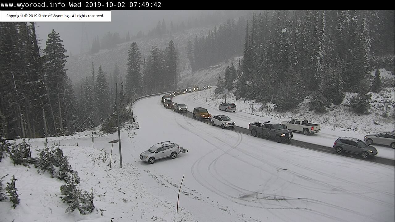
Taking a look into the next 7 days brings a possible return of unsettled conditions to the Pacific Northwest and perhaps New Englands first dusting of the season in northern Maine or Vermont late this week. Some light snow is falling currently in the Tetons that could continue occasionally over the next 24-48 hours (Light amounts). Some light snow is also on the model runs for central Idaho and southern Montana over the next 48 hours. Colder temps have driven the snow level down to pass level in the Tetons as of press time. Light snow is also falling in Park City UT this morning. Warmer and drier conditions are going to return for the upcoming weekend before some cooling again next week.
Below: Teton Pass- Snowing lightly with slick conditions.

Looking further ahead a moderate trough is likely towards the beginning of next week (Tuesday) with colder temps for the Pacific Northwest and perhaps western BC (Whistler). That system seems to favor the northern Cascades, however it's too early to predict with accuracy this far out.
Below: Cooling conditions with near freezing temps by Tuesday/Wednesday next week at 4800 feet.

Below: Snowfall in the northern Cascades could approach moderate amounts by next Tuesday/Wednesday. Western BC may also reap some light or moderate rewards next week.

The leaves are near peak in many areas of the Rockies right now! You can choose to bike or ski depending on your location right now. Many folks are skinning in the mountains near Glacier National Park and southern Alberta right now. No ski area is currently open so enjoy the solitude while you can. Please tag #powderchasers on your photos that we often share on social media. Please support our sponsors on the webpage! The Concierge program has been updated on the website with 4 levels to choose from if you're interested in chasing powder this season. The folks in northern Montana could have used a snoshark last weekend as our tool of choice for cleaning feet of snow off cars. Enjoy the mix of weather that fall has brought us and it's time to start looking forward to powder alerts (Sign up at www.powderchasers.com).
Powderchaser Steve


