
Summary:
Light to moderate snow for the northern Cascades, heavier snow for northern California late this weekend and again Tuesday next week. A very large storm might drop several feet over the Front Range of Colorado late next week
This will be a short update: Light to moderate snow is likely favoring the northern Cascades of Washington for Saturday morning near Mt Baker (3-9). Lighter snow is possible further south. Northern California near Mt Shasta grabs moderate snowfall while the core of the Sierra near Tahoe only grabs leftovers (3-7). The further north you travel the higher the amounts. Chase to Baker for Saturday if possible. Tahoe Saturday will see a much needed refresh.
Late this weekend another storm brings moderate snow to Mt Baker spreading south to Stevens Pass. Light snow will be falling in the southern WA Cascades. (Ride Sunday).
For deeper snow Monday night has a decent chance of moderate snow for the Oregon Cascades and heavy snow possible for Mt. Shasta for Tuesday morning. Eyes are also watching Timberline and Mt Hood for Tuesday. Bachelor is a wildcard.
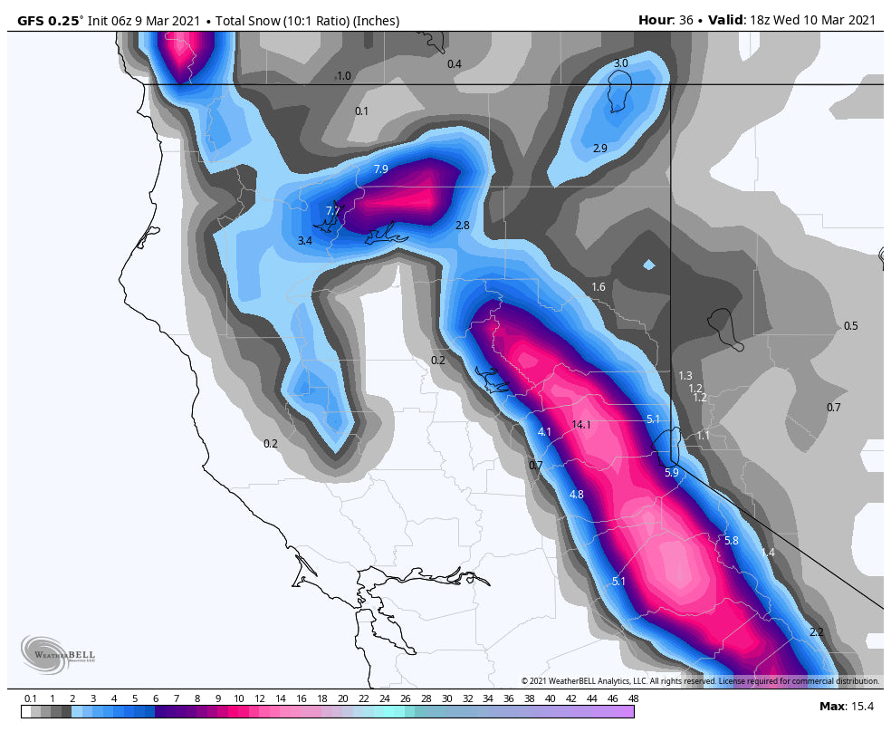
Light to moderate snow is also likely for the Tahoe Basin Tuesday/Wednesday but amounts might come up short for chasing powder (Refreshes).
In the Rockies light to moderate snow, perhaps even a tad higher are likely for western Idaho (McCall area mountains) for Tuesday. That system will also bring light or moderate snow to the Tetons, southern Montana, Wasatch, and northern Colorado. While it is not an overly moist system, some chases are possible early to midweek in the Rockies.
The interesting notes come in the extended forecast where the models are hinting at a very large system with perhaps several feet of snow for the Front Range of Colorado late next week. While it is still 7 days away, I would have to go with low confidence however, if the models hold up we will chasing deepness somewhere closest to the Front Range by Friday.
Powderchaser Steve


