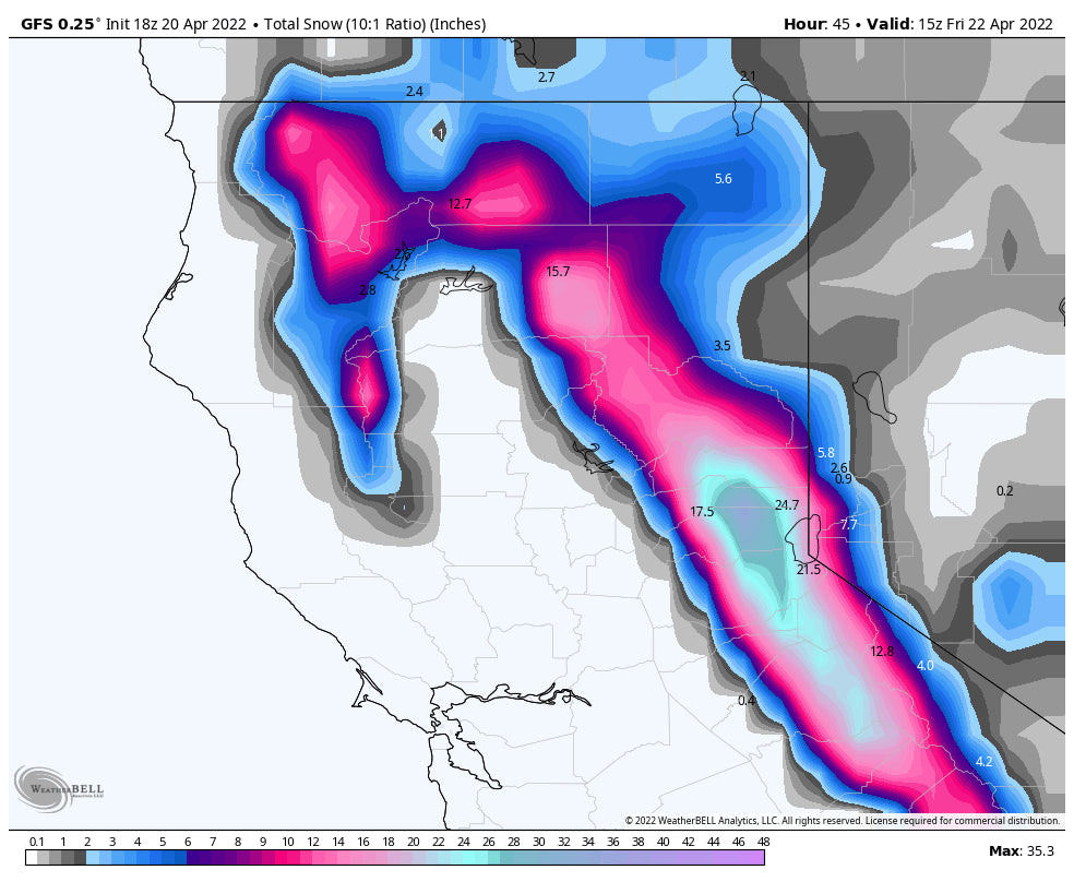
Quick update as of 4AM Friday. This feels a bit more like January than late April.
Heavy snow has blanketed the Sierra with over 3 feet for the northern regions, and 1-2 feet in the south central ranges. Mammoth had 14 inches since closing Thursday for Friday AM freshies. Lets hope the summit opens! Kirkwood skied creamy deep on Thursday but will be blower fresh on Friday (Open). Palisades who was nailed on Thursday (29 inches) with additional snow into Friday was closed due to strong winds. They are likely to open on Friday with 3 feet plus of freshies (Limited terrain).
For the Rockies, our eyes are on the Wasatch Range with a strong system pushing high winds and snowfall to the Cottonwoods Friday mid morning through early Saturday. SW winds will crank Friday morning easing slightly for the afternoon (Storm ski). Temps will be dropping late Friday as winds veer NW and continue to bring decent snowfall to the Cottonwoods (quality increasing). Storm totals will likely be in the 6-9 inch range Friday (By 3PM), and another 7-9 inches Friday night. Expect some closures on Friday (Winds or intense snowfall). 1st chairs Saturday will be good. Caveat: There is a brief period of strong winds later Friday night that might take quality down in exposed areas (Winds will be from the NW). Bottom Line: This is chase worthy storm.
The Tetons are a bit west of the best moisture feed. It's likely 4-8 inches fall by Friday morning with heavier amounts east in the Wind River Ranges and further north into Southern Montana. We are bullish for Big Sky.
Colorado grabs double digits in the northern mountains (Steamboat is closed), Rabbit Ears Pass, extending into the western side of the I-70 corridor very late Friday into Sunday. Summit County will likely grab 4-9 inches with Vail Pass on the higher side (Eagle County).
Keep your snow tires on! Feel free to donate from our homepage if you scored powder this season.
We will be issuing a final post at some point soon for the season.
Powderchaser Steve


