This post is sponsored by Mountain Collective. Buy a Mountain Collective pass before pricing goes up 11/19.
There's plenty to talk about in the west this week, with a storm currently moving through the PNW into the Intermountain West, and another one lining up to kick off on Saturday.
First, let's talk about the storm that's currently ongoing, and what else it has in store for the rest of the weekend.
PNW
The PNW is currently on the tail-end of this storm. Snow levels in the past few days have hovered between 4,000 and 5,000 feet.
Here are a few estimated (unofficial) totals in the Pacific Northwest and Canada over the past 4 days based on telemetry and a few official reports.
- Mt Baker: 18 inches (Mid to upper elevations)
- Whistler: 18 inches (Mid to upper elevations)
- Stevens Pass: 10 inches (upper elevations)
- Crystal: 8-11 inches
- Revelstoke: 15 inches
- Bachelor: 13 inches
- Timberline Lodge: 13 inches
Precip will be mostly wrapped up by Friday morning/early afternoon. Taking a look at the HRRR below, you can see that Washington is in for another 3-12" and the Oregon Cascades should see another 2-5":

California
That same system will slide south into California late Thursday morning/early Thursday afternoon, lasting through Friday night. Snow levels will be around 5,000ft initially, dropping to 3,000ft by the end of the storm. Accumulations by Saturday morning (11/16) will be as follows:
- Sierra Crest (Sugar Bowl, Palisades, Kirkwood): 3-7"
- Central Lake Tahoe (Northstar): 2-4"
- East Lake Tahoe (Mt Rose, Heavenly): 3-6"
Below is the ECMWF forecast by Saturday morning:

Utah
Moisture will arrive in Utah on Friday afternoon, with snowfall lasting into Saturday evening/night. Snow levels will be highest at the start of the precipitation, around 6,000 feet, meaning it will be below resort base elevations the entire time. By Saturday night, we're looking at the following totals:
- Cottonwood resorts: 6-10"
- PC/DV: 3-7"
- PowMow: 3-6"
- Beaver Mountain: 1-3"
- Eagle Point: 2-5"
ID/MT/WY/CO
This region will see snowfall Friday morning through Saturday night. Nothing huge, just consistent moderate accumulations across the area. By Saturday night:
- Schweitzer: 4-6"
- Sun Valley: 1-2"
- Big Sky: 3-5"
- Grand Targhee: 4-8"
- Jackson Hole: 2-4"
Colorado will hardly see any accumulation from this system. Expect a trace in the northwest mountains at most.
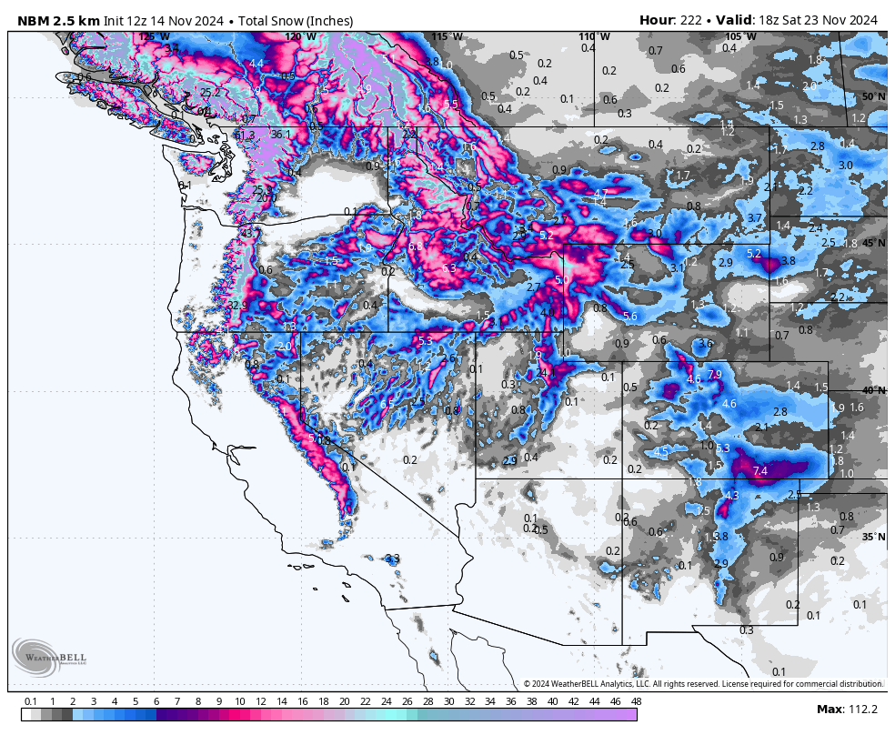
Looking ahead
Our next storm system rolls into the Pacific Northwest on Saturday afternoon, lasting through Monday night for the PNW. Snow levels for the PNW should stay below 3,500 feet at Mt Baker. Early Sunday morning, temperatures will spike massively in the south (Oregon) until Sunday afternoon when colder temperatures on the backside sweep in; this will lead to snow levels above 7,000 feet and mostly rain during this time for resorts. This will throw off reported totals, as the rain will melt any snow that falls before it. Here are totals around the region at mid-mountain elevations from this second storm by Tuesday morning (11/19):
- Mt Baker: 18-30"
- Stevens Pass: 20-32"
- Alpental: 15-25" (with rain on Sunday morning to 5,000 feet)
- Crystal Mountain: 10-20"
- Timberline: 15-22" (major rain on Sunday)
- Mt Bachelor: 8-16" (not as much rain)
This will bring a few inches to Tahoe, 1-4" for resorts looks like a fairly safe bet right now from Sunday night into Monday morning/early afternoon.
In Utah, we're looking at another solid dump from Monday afternoon into Tuesday evening:
- Cottonwood resorts: 5-10"
- PC/DV: 3-6"
- PowMow: 2-6"
- Beaver Mountain: 2-5"
- Eagle Point: 2-5"
Colorado will also finally get in on the action between Tuesday morning and Thursday afternoon. Details remain very up in the air, with the ECMWF predicting a pretty decent storm favoring the Front Range and the GFS only laying down a few inches for the northwest mountains:


