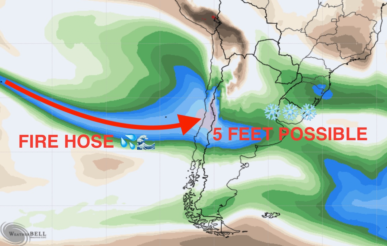
Bottom line: warm and wet storm this week will bring huge accumulations to upper elevations. A parade of storms is forecasted to begin this week and continue through at least the end of the month.
A major winter system will hammer South America this week, bringing 1-2+ feet for many resorts, with the heaviest accumulations in the north near Valle Nevado, where mid mountain is likely looking at over 4 FEET of snow. The bulk of the storm will last from Wednesday morning to Friday night in the south and Thursday morning to Saturday afternoon in the north. An active pattern is likely beyond this, with most major models indicating a nearly nonstop train of storms through at least the end of the month.
This storm has very different characteristics for the north and the south, so I’ll break this post up into two sections, one for the south (Cerro Catedral, Cerro Bayo, Chapelco, Pucon, Corralco, Caviahue) and one for the north (Valle Nevado, Portillo, Las Leñas).
South
Overall, this storm will come in warm and wet for southern resorts, which is the opposite of what we’ve seen so far this year, where the south stays cold and the north gets the warmer moisture. Below are forecasted lower atmospheric temperature anomalies during the storm. Note the unusually mild conditions.

Heavy precipitation will move into the mountains on Wednesday afternoon. Snow levels will likely be around 6,500-8,000 feet (2,000-2,500m) for most of the storm, meaning most resorts in this region will see mostly sleet/rain with a dusting on the tail end of the storm as temperatures cool. The one resort that may see more snow is Cerro Catedral, due to its higher elevation. Sleet should switch to snow at mid-mountain at Catedral on Thursday night, and could drop 10-15” (25-40cm) by Friday night.
The next storm in the south should get rolling early Sunday morning and last through Tuesday night or so. This storm is looking slightly more promising, with colder temperatures in the forecast bringing better chances for lower elevation snow.
North
The north will be much more exciting, with major accumulations expected, especially near Valle Nevado. Precipitation will begin filling in the north on Wednesday night and should be nuking by Thursday morning. This storm will still be warm, so snow down to the bases is not guaranteed. However, the higher elevation of the resorts here - especially Valle Nevado and Portillo - certainly helps.
The heaviest precipitation will fall on Thursday, Friday, and Saturday, with snow levels hovering between 8,000-9,000 feet (2,400-2,750m). Mid-mountain at Valle Nevado will likely remain all snow during the duration of the storm, while Portillo should see more sleet at mid mountain. Unfortunately, Las Leñas’ mid-mountain should sit below the snow line for the entirety of the storm, meaning most of the mountain will not see snow during this period.
Most of the precipitation will be done on Saturday night, although light snowfall will linger into the start of next week. By Sunday morning, I can see totals of 50-70” at Valle Nevado (with much more at higher elevations) and 15-25” at Portillo (although this will be mixed in with a lot of sleet throughout the storm). Keep in mind that this storm is warm and wet, meaning just a few hundred feet can mean the difference between completely rain and feet of snow. Upper elevations of Portillo will be closer to the Valle Nevado numbers.
Below: ECMWF snowfall forecast through Saturday night. Notice the snowfall bullseye in the northern mountains - right where Valle Nevado and Portillo are located!
 Looking ahead
Looking ahead, this active pattern appears to continue through the end of the month. The global models have a near-constant stream of moisture hammering the mountains. Check out the ECMWF (European model) and GFS (American model) 10 day forecasted precipitation anomaly below. Global ensembles are also onboard with this extremely wet solution:


However, global ensembles are indicating that this period will also be anomalously warm, especially in the north, meaning these storms could continue to come in warm and wet:

Please help fund our Powder Community by donating here to Powderchasers. Check out our merchandise and sign up for our Concierge program if you want to chase powder. We are looking to add a few sponsors this season so send us an email to powderchasersmedia@gmail.com if you are interested in reaching over 3 million skiers per season. Our sponsors keep us up and running.
Powderchasers Forecast Team


