Summary: Prolonged cold winter pattern for Canada brings deep snow for the next several days. This will migrate into the Northern Rockies beginning Saturday. Folks will be skiing powder in Canada and perhaps Montana by Sunday. Snow will continue at times next week favoring the northern Rockies. There is a hint of systems digging further south by next weekend.
Forecast:
Thus far, winter has been well underway in Canada where Revelstoke has had several days of snowfall burying the Snow Camera yesterday. Snow was also fell at lower elevations in the town of Revy. While the Canadian Border remains closed, this might be the season where the Canadians reap deep turns on empty slopes at least for the short term.
Below: Buried snow camera at Revelstoke Mountain Resort on Wednesday.

The next 5 days will feature a low pressure system that remains in place over British Columbia and Alberta pumping periodic moderate events that trickle into Montana and Wyoming beginning this weekend. The models are slamming interior BC with up to 2 feet of powder through Monday. Most snow will fall Friday night into Saturday and again early next week for BC. Very cold temperatures will be featured with these events with well below normal temps for the northern Rockies and Canada.
Below: Significant snow (30CM) likely for interior BC Friday night/Saturday

Below: Well below temps for the northern Rockies and Canada. The most frigid air stays along and east of the Continental Divide (-17C at 10K feet) with the light green and pink colors.

Snow will be falling over northern Montana Saturday/Sunday favoring areas north and East of Whitefish. Glacier National Park and perhaps even Whitefish Ski area (Wildcard) could see moderate amounts by Sunday morning (5-10). That system will drag south over interior Montana. The European Model is bullish for 12 inches or more south of Glacier National Park and East of Missoula. This might land a deep surprise for Tamarack Ski area near Seeley Lake. Light snow will also be falling near Big Sky and areas north of Bozeman (Bridger Bowl) Saturday-Sunday. Moderate snow is likely further east towards the Wyoming border.
Below: GFS model for Montana/Wyoming for total snow through Monday. The European model is much more bullish for deeper snows especially southern Glacier National Park or areas south towards Seeley Lake. Bottom Line: Central Montana and resorts east along the Wyoming border might fare best. Keep reading for the extended.

Extended:
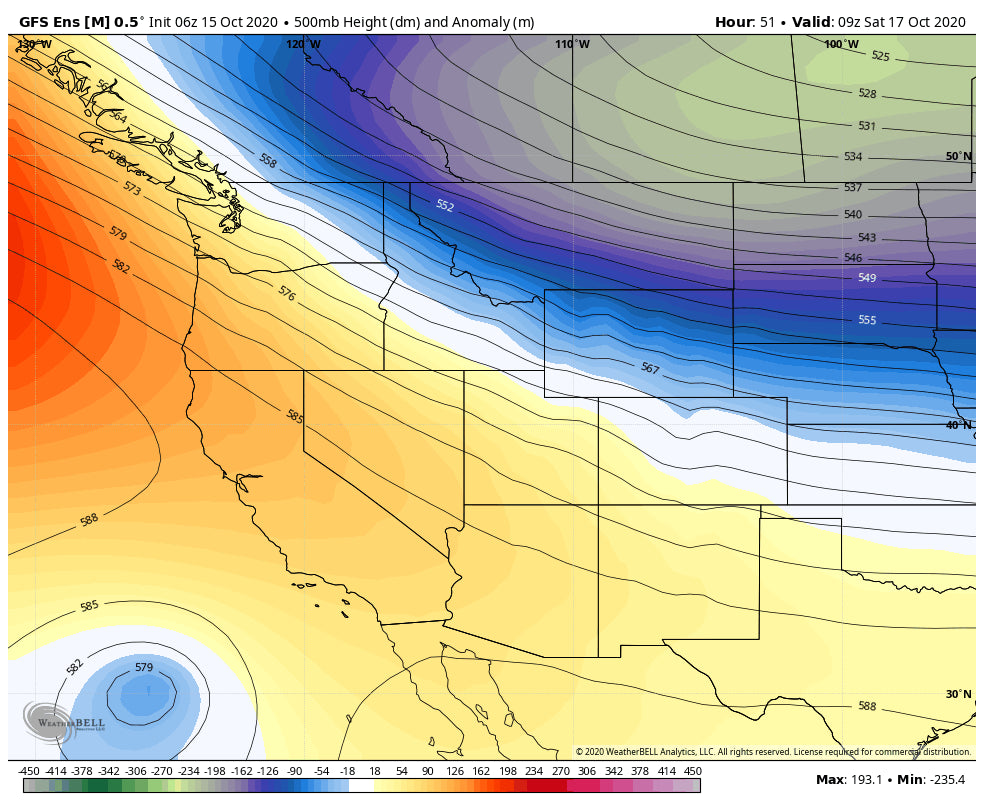
Low pressue will continue to pump periodic moisture into BC and the northern Rockies next week. Additional snowfall is likely for north/central Montana, and northern Wyoming Tuesday and again late next week. The models hint at a trend for some of this snow to dig a bit further west and south. If that happens, Big Sky and Bridger could see deeper events. The long range ensembles show a chance of a decent system for the Pacific Northwest late next week. Colorado and perhaps Utah is also likley to be in better position as more moisture might dig further south towards next weekend (Low confidence being 8-9 days out).
Below: Ensembles show a trend for low pressure to dig a bit further west and south late next week.

Thus far, the trend towards a decent La Nina year is very favorable. The models point to La Nina possibly strengthening. This may keep conditions colder and wetter favoring the Pacific Northwest, and northern Rockies. There are also historic winters that did just the opposite. So far, the systems impacting the west go along with our La Nina forecast. Also, early season snow is often not an indicator for who will see the highest totals once we get into our prime season.
Here is a shout out to our partner Indy Pass that supports local ski areas. For just $199 you can get 2 days of skiing at over 50 resorts! You can even check out our partner Beaver Mountain in northern Utah.
Enjoy the early season powder everyone! Especially those with a Canadian Passport!
Powderchaser Steve


