Good Morning everyone! Be sure to check out our new promotion with Mountain Collective at the bottom of this post (SAVE $75).
Synopsis
New England snowfall is just beginning this morning favoring the northern regions of Vermont, New Hampshire, and Maine. Yesterday, the totals were decreased to 2-6 inches in the forecast. The system is coming in a bit slower than expected with amounts staying on the light side peaking by late AM Thursday through the early evening hours. Amounts are still in the 2-6 inch range with my confidence on the lower end of the spectrum. Stowe, Jay Peak, and spots north impacted by cold air orographics, some lake effect if lucky may come up on the higher end. The long term offers a much deeper storm Monday night and Tuesday.
Below: Short term high-resolution models showing light snow in the next 12 hours for a wide area of Vermont and less for New Hampshire and Maine.

In the west, the high-pressure ridge continues to send moisture north into Canada (Light) with the jet pushing moisture south over the Midwest and eastern areas of the United States. The eastern fringes of the Rockies will be brushed by very light snow at times next week, especially Monday (1-3 inches possible for central Montana, Wyoming and eastern Colorado). This will remain east of most ski areas but some flakes might be falling near the Divide.
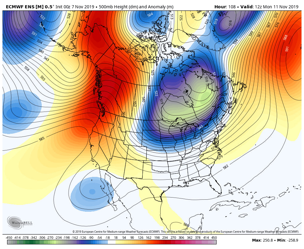
Below High pressure in the west with some influence on the backside of the Trough over the midwest extending some very light snow on the eastern side of the Rockies (Montana, Wyoming, Colorado). New England will score some decent snowfall with this system by Tuesday.

In the extended outlook, models are bringing in a stong trough into New England by Tuesday. In the west, the ridge weakens somewhat with no signs of any significant troughs in the short term. There are some weak signals on the ensembles and operational models that a weak system may end up on the California Coast at some point mid to late next week (Sierra). It's possible that some snow returns to the Chase Forecast for the west around the 16th or 17th of November. While the weakening of the ridge is good, I am not sure how much moisture the west will see but feel more confident in the latter half of November.
Below: New England could get a decent storm Monday Night and Tuesday!

ANNOUNCEMENT - PROMO FOR MOUNTAIN COLLECTIVE PASS. (Save $75 Promotion)
Sign up for the Powder Concierge and recieve $75 off a Mountain Collective Pass this season. SImply sign up for any level on the Concierge and we will send you a discount code for your pass. Our Conicerge levels start at just $75 bucks and help to fund our forecasts.
Powderchaser Steve


