Tomorrow is the first official day of Spring (8:06 PM PST). The sun will sit directly over the earths equator. The northern and southern hemispheres share the suns rays equally at the equinox with roughly the same amount of daylight and darkness will be evident.
Sponsor Alert: Ikon early season pass rates just released. You can renew or purchase new passes here. at the lowest rates.
Please support our retail supported Skis.com who has up to 70% off sale going on. Any sales of $200 or more gain you a free Powderchasers shirt (Just email us). They are a family owned.

Finally, today, March 18 is your last day to purchase your INDY PASS here. It is unknown when or if sales will resume (Last year they filled requests in the Fall).
Forecast:
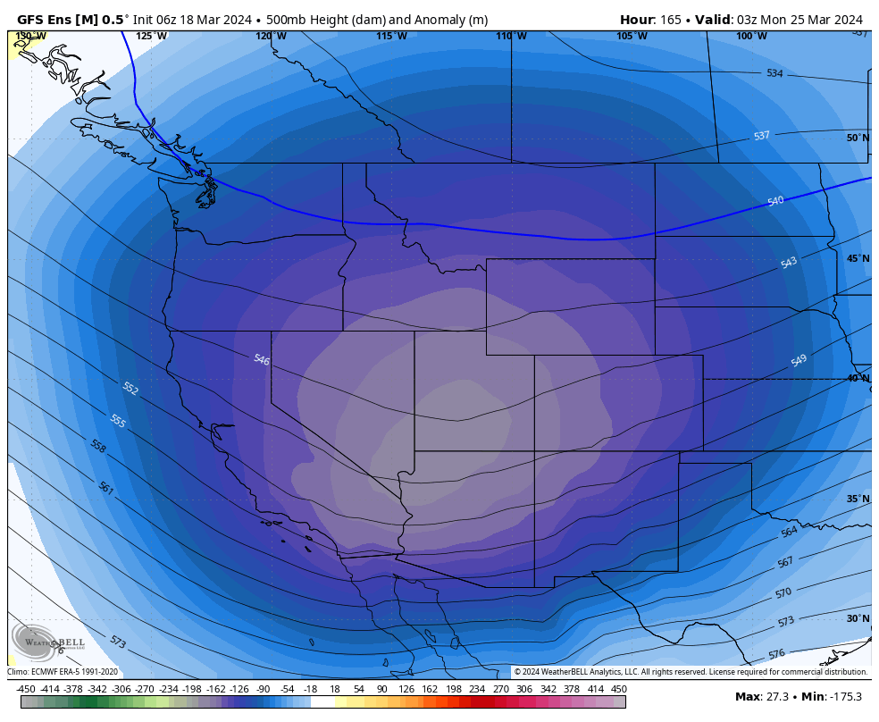
Our pesky low that has been sitting over the 4 corners for the past 4-5 days is still bringing a few light snow showers to New Mexico (30 inch-4 day storm totals for a few areas west of Santa Fe). It seems the highest ski area totals came for smaller resorts in the west over the past 4-5 days (Eldora near Boulder-35-40 inches and Pajarito near Los Alamos).
The next 7 days should offer a few possible chase options for both Canada and areas of the west.
By midweek low pressure noted in central Canada pushes moisture on its backside west towards Alberta and the interior of BC. Cold air is noted primarily on the Alberta/BC border bringing decent quality powder to Banff, Sunshine Village and Lake Louise Ski areas. Expect snowfall to peak Wednesday/Thursday (8-12 inches). Further west, BC resorts will see warmer conditions (Snow levels 4500) with 4-8 inches possible towards Revelstoke. We would suggest chasing further east towards the Alberta border.
Below: Snowfall filling in along the BC/Alberta border from Wednesday morning to Thursday morning. Snow will extend into western BC towards Revy and Kicking Horse as well as the southern areas of closest to the Alberta border. Temps are colder in Alberta with a cold front confined to these areas. Snow is also noted for northern Montana near GNP (Decent totals) with less to the west at Whitefish. Light snow is also noted for southern Montana and the Tetons.

Below: High pressure midweek over the west with a low in central Canada pushing some powder towards the interior of BC and along the Alberta border (Wed-Thursday). An approaching low is noted in the Pacific that will enter the Sierra Friday night and the Rockies for Saturday PM/Sunday.

An approaching low pressure system will bring snowfall back to the west by the weekend.
Below: Map is from Saturday AM to Monday night. Snowfall increases over the PNW (Washington), and Sierra ranges extending into the Wasatch, Tetons and Colorado.

The Sierra storm starts out warm (Snow levels 7-8K) but gradually improves quality by Saturday midday with temps dropping (6K). Saturday and Sunday could offer some decent turns. It is a bit early to forecast totals, but at this point we are going with 7-12 at upper elevations and 2-4 at the bases.
Below. U of U ensembles based only on 1 model (GFS) show a possible scenario for Alta of near 12 inches by Sunday (Too far out for confidence). Temps start out with snow levels near 7-8K and drop below 6000 by Sunday morning.
 Below: Low pressure noted to rapidly move into the core of the central Rockies by Sunday as it departs the Sierra. We have decent confidence of some future low end powder alerts for the weekend (Utah, Colorado, Wyoming, Montana, New Mexico).

Below: Looking further out towards week #2 March 27 there is another low that will likely swing into the Sierra Range. We should see a relatively busy end to the month in the west. High pressure is noted to fill in for early April as the jet pushes any moisture north towards the PNW or Canada.

HELP US OUT! Please donate here to Powderchasers if you have taken advantage of our free forecasts. This Is our number one source of revenue. Free swag for you on all donations from $50 and up. $100 donations grab you a custom shirt also!
We have new Powderchasers shirts fresh off production for sale currently for just $32 (Front and back powder)


Don't forget if you want to chase powder to the best locations every time, join our concierge package here. This provides custom 1:1 consults. You won't miss the deep.
Follow us on social media @powderchasers on FB and Instagram.
Powderchaser Steve- Forecaster


