Summary
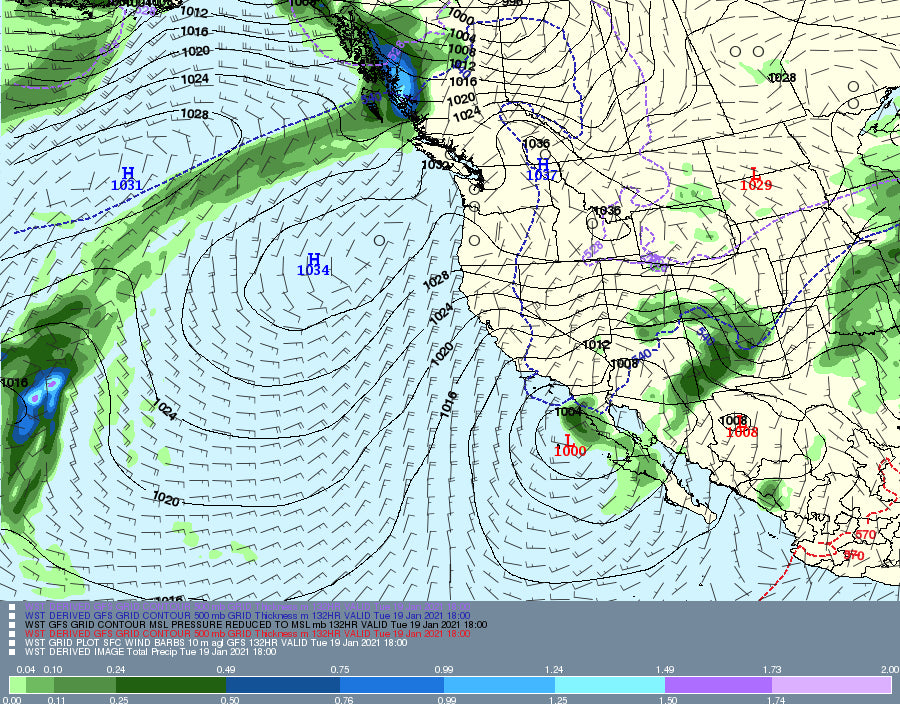
An active pattern of light to moderate events will refresh Montana, Wyoming, Utah, Colorado , Arizona and perhaps New Mexico and Arizona early next week
Recap: Wet snow and lots of wind fell in the Tetons yesterday. I forecasted 4-8 with 9 inches on the telemetry for JHMR and 5 for Targhee. I felt good going into this forecast with low snow ratios (Less snow per inch of water) and strong winds that shut down the JHMR tram around 1PM (That does not happen often). 2-3 inches of the totals fell overnight with much colder temps. In fact, it was in the mid to upper 20's on Wednesday and only in the single digits as of Thursday morning. You might find some dust on crust? Some other lifts and terrain were closed all day so the sum totals of untracked in these areas might ski very well. Targhee shut down upper elevations lifts in the afternoon.
Forecast:
I am posting from Hawaii this morning. If deep powder is not falling I decided to grab my camping gear, Brompton Fold up bike, and a last minute Covid test and head out until Monday. Its gong to be 84 today in Maui and I can't wait to hang out in Hana for the next few days. \Brown Pow\"
The next several days brings some light snow for the central and northern Cascades (Alpental, Snoqualmie, Stevens, Baker) for both Friday and Sunday. That will filter into the Panhandle of north-central Idaho (Sunday) and eventually in the Rockies for Monday and Tuesday. Colder air will accompany these systems with good quality density.
The models don't agree on the exact path of the Monday event for the Rockies. Looking at several runs of scenarios this morning, it is likely that southern Montana come up with decent amounts (5-9) with the Tetons in the 3-7 range. Its way to early to forecast amounts this far out especially with discrepancy in the models. In fact, for Montana some of the models show the highest amounts in the central portion of the State east of many of the ski areas. This season has seen many storms pass just to the south of Big Sky and Bridger Bowl. That is unlikely the case on this system.
The Tetons might not be too far behind Montana, however there is discrepancy in the models with some showing less. The Wasatch may also be a decent choice for Monday morning. While this is not a major event for the Rockies, it has potencial to outperform the models with colder temps, good quality and bring some decent conditions to many ski areas.
Bottom Line: Moderate colder system for the Northern Rockies for Monday. Montana, Utah and Wyoming are all initially on the list for States to watch. Moisture shifts south into the 4 corners and perhaps most of Colorado for Monday/Tuesday.
Skip to the extended for an active pattern for AZ, CO, and perhaps NM
Extended:
The Monday system over the Northern Rockies drops into the central and southern Rockies for Monday PM to Tuesday AM. The European models shows a significant storm possible for the San Juan ranges of Colorado (Wolf Creek, Purgatory, Silverton, Telluride) while the American Models shows the system further north in Colorado and weaker. Some snow will be falling as early as Monday morning in the northern mountains of Colorado (Steamboat).
Bottom Line: Next week will bring a moderate event for Montana, Wyoming and perhaps northern Utah especially Sunday night or Monday (Widespread snowfall). There is not much agreement on who sees the highest amounts yet. Monday night and Tuesday bring a very good chance of moderate to perhaps heavier snow for certain regions of Colorado with poor agreement on the models. The San Juan Range could be deep if you believe the European Model. Arizona and New Mexico are likely to get into the action depending on which model you want to believe. You could chase powder from the north to the south for Tuesday. More to follow on a future forecast.
Below: Plumes from the University of Utah multiple ensemble runs showing some moderate snow for Alta on Monday morning, There is still disagreement in the models.

Below: Snowfall showing an average of 10 inches for Big Sky for Monday morning. there is still disagreeemnt in the models.

Below; Vail Pass- Notice there are several small storms initially this weekend and a bump in the Monday night to Tuesday period. The total amounts range from 4-12 inches with lots of uncertainty. There will be some light snow this weekend with a stronger push of moisture for Monday afternoon.

I am not sure how many posts you will see this week camping in Hana. I hope to get out a few updates in the next several days.
Powderchaser Steve


