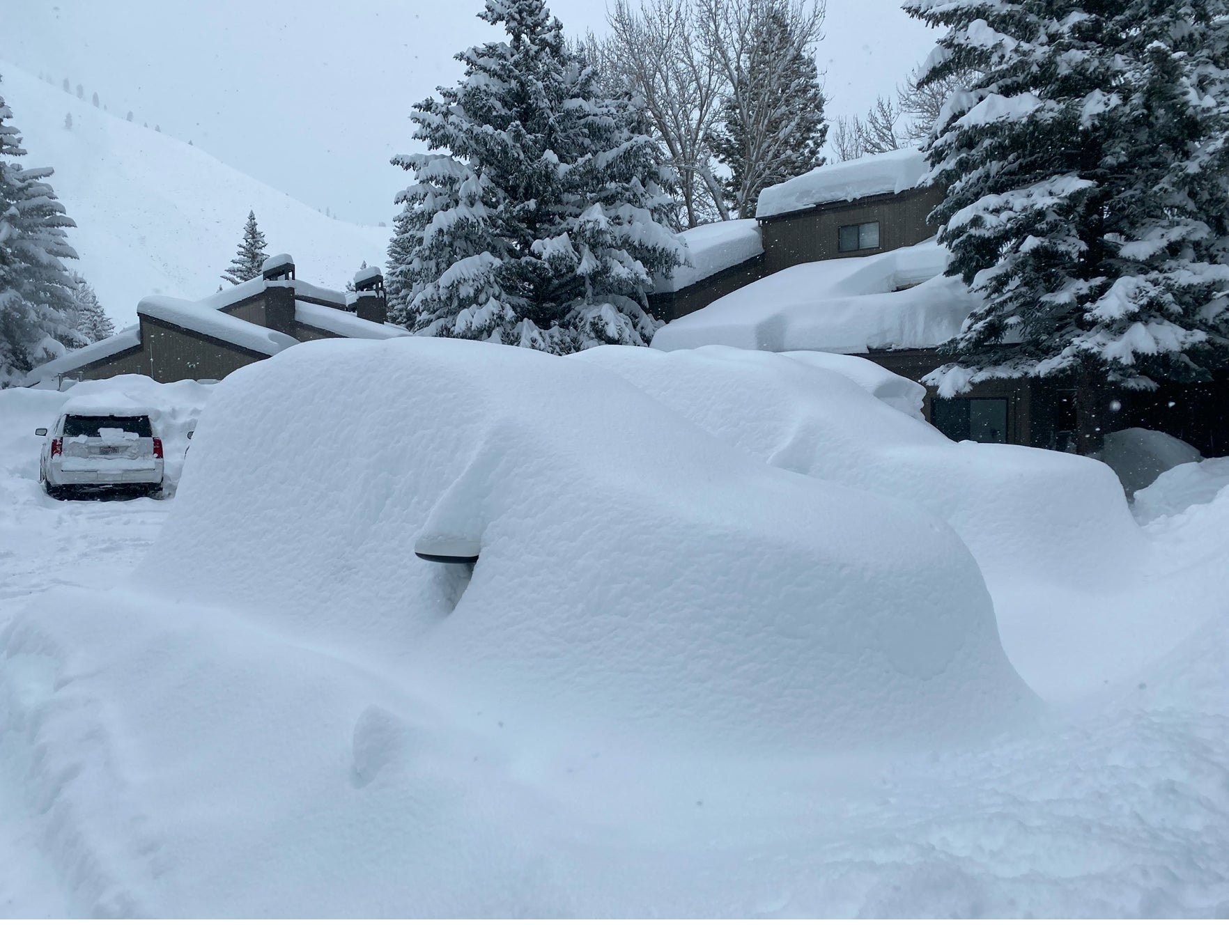
This post was originally drafted on Thursday evening. We are on the chase and just scored one of our deepest days ever, at Sun valley Idaho.
The chase is continuing! Today at Sun Valley brought some of the deepest runs of our season, literally blowing up into our armpits. The term \Getting pitted\" is a phenomena that came true. Total snowfall for the Sawtooth Range is in the 35-40 inch range currently. Well that does not hold a stick to a few of the snow totals for California as of 7AM Thursday
1) Mammoth 76 inches
2) Mount Rose 51 inches
3) Sugar Bowl 30 inches
4) Squaw 28 inches
Its pretty amazing that nearly as much moisture from Tahoe extended north into south/central Idaho that could potentially out number a few areas in CA by Friday afternoon.
Below: Thursday in Sun Valley! Photo @powderchasersteve via Instagram

The Tetons nabbed an epic day with 14 inches at JHMR on Thursday morning (Light density). we had forecasted them as a wildcard pick with perhaps close to double digits (Unlikely). The storm over delivered and most of that powder fell during a short period after midnight. No complaints from Wyoming!
Update: Friday morning- Next storm is on it's heals brings light to moderate snow to the Tetons Friday and another 5-10 Friday night and Saturday. SW winds initially shift to the west.
The next systems to hit the west are underway currently in the Sierra Thursday evening. The models show 9-12 inches for the northern Sierra (Squaw) and 12-20 inches for the southern areas (Mammoth especially). The short term high resolution model verifies the higher amounts likely coming in for the central and southern Sierra for Friday morning. You might want to chase to those resorts that are getting more manageable snow totals. Late Friday AM should offer some catch up work for all areas of the Sierra.
Below: Short term resolution model for the Sierra Thursday night showing another good burst of snowfall. Central or southern ends of the lake might be favored including Mammoth.

Elsewhere of highlight, the Sawtooths show another 4-10 inches for Thursday night into Friday. They might not see a break until late AM or early PM Friday. The Tetons wills see light to moderate amounts for Friday morning (2-7). More snow is likely further north into the North entrance of the National Park.
Update Friday: Another 8 inches has fallen at the summit of Sun Valley for Friday morning. They should exceed 40 inch storm totals!
The Wasatch will also score powder midday Friday through early Saturday that could bring a decent day to Utah (Not a huge storm, but decent freshening).
UPDATE: Friday Morning- This storm is looking a bit better, with 15-20:1 snow ratios. Starts out with S winds (Sundance, Park City, Deer Valley could do well on the onset late Friday) and finishes with NW winds (Little Cottonwood, Perhaps Powder Mountain). Expecting 7-9 inches for the I-80 corridor and north, with perhaps 9-13 inches for the Cottonwoods by Friday mid morning.
Colorado once again scores the most powder in the southern mountains late Friday to Saturday. Aim for Telluride, Purgatory, Wolf Creek for 4-7 inches on Saturday morning. 2-5 inches is possible further north and along I-70 but its not a major event. Most of that snow is going to fall on the western side of the I-70 corridor.
Extended:
Very exciting models! The PNW will finally fire by the weekend increasing perhaps for the western areas of Washington and Oregon for Sunday to Monday. The pattern initially favors the North Cascades (Baker) and areas on the Oregon/Washington border. That moisture edges closer to Crystal, Stevens, and the I-90 corridor Sunday PM to Monday (Might be some decent powder late Sunday or early Monday).
The Sierra grabs another good storm for Monday night to Tuesday that moves east over the Rockies late Tuesday to Wednesday. There is good signal that many locations in the Rockies will score some deep powder during this period. Some models are showing that Colorado may finally score some deep powder along the I-70 corridor, and a more generalized mid winter pattern. While this system is a quick mover, it should produce decent snow totals for most of the north/central Rockies. Let's hope this pans out.
Friday update: Next week could score some very deep snow in the Rockies.
See you on the slopes!
Powderchaser Steve - Instagram @powderchasersteve


