Summary:
While California is digging out, the Wasatch finally scored a deep dump on Saturday morning. The next 5 days will be very active for the Northwest. The Sierra, Tetons, Wasatch, AZ, CO, and NM all stand decent chances of snow next week.
Forecast:
We chased from Idaho to Utah Friday night. The short-term resolution models showed very heavy precipitation rates for the Wasatch Range favoring the Cottonwoods with a post-frontal NW flow. The initial band of moisture with southerly winds really ramped things up for Sundance, Solitude, Snowbasin, and areas favored by SW flow. NW post-frontal snow showers continued all day for the upper Cottonwoods (BCC and LCC). Snow totals by Saturday morning were impressive and the quality excellent.
Snowbird- 18 inches
Brighton- 14 inches
Solitude- 14 inches
Snowbasin 13 inches
Deer Valley 10 inches
And of course, let's share Mammoth Mountain storm totals at 113 inches at the Summit! While the Sierra certainly won in snow totals, followed by the Sawtooths in Idaho (50 plus inches), the best chase may have been in the Tetons or Sawtooths on Thursday or Friday and the Wasatch on Saturday. Storm chasing depends on so many factors (Winds, open trails, avalanche mitigation, overnight snow). We nailed a good chase this week! Everyone came out a winner if you were at the right rope drop last week!
The chase opportunities in the next 5 days are tricky due to a splitting low-pressure system moving over the Rockies by midweek. The Sierra is with high confidence going to grab a decent storm Monday night through Tuesday. This might favor the northern Regions.
The upcoming week is very active for the Northwest. Snow is falling under SW flow initially this week which will favor Mt Baker. 14 inches has fallen at press time of this post-Saturday evening. The pattern continues with some warming late this weekend followed by cooling by early next week. Mountains further south along I-90, Snohomish County, Pierce County, and Northern Oregon will see snowfall every 24 hours however lighter than the northern Cascades. Mt Baker could nab several feet in the upcoming 2-3 days. Mountains further south will see an uptick in snow totals early next week. Decent Westerly flow with cold air sets up for more significant snow for Stevens Pass or Alptental by Wednesday.
Below: Low pressure over the PNW early next week with continued moisture through at least midweek.

Things ramp up for the Sierra Monday night into Tuesday with a good 12-18 inch storm, decent temps, but strong winds. The Good: Deep snow, manageable numbers, some overnight Monday, and storm ski Tuesday. The Bad: Windy period Monday night into Tuesday morning (Quality could degrade at upper elevations especially).
That system splits and sends the main low south that eventually ends up in the 4 corners by late next week. Arizona might be in a deep scoring position by Thursday. The northern branch of the split low ends up over the Tetons, southern Montana, and Wasatch by Tuesday night for at least a moderate snow event. The models are unclear who wins the battle between the Tetons or Wasatch. Currently, I favor the Tetons for the location of highest moisture on Wednesday however, NW flow behind the front could spell another surprise dump for the Wasatch (We need to narrow in the forecast). Look what happened in Utah on Saturday!
Below: Splitting low-pressure system (Blue colors) with a southern and northern branch by Wednesday. This will impact the Tetons, southern Montana, and Utah by Tuesday night.

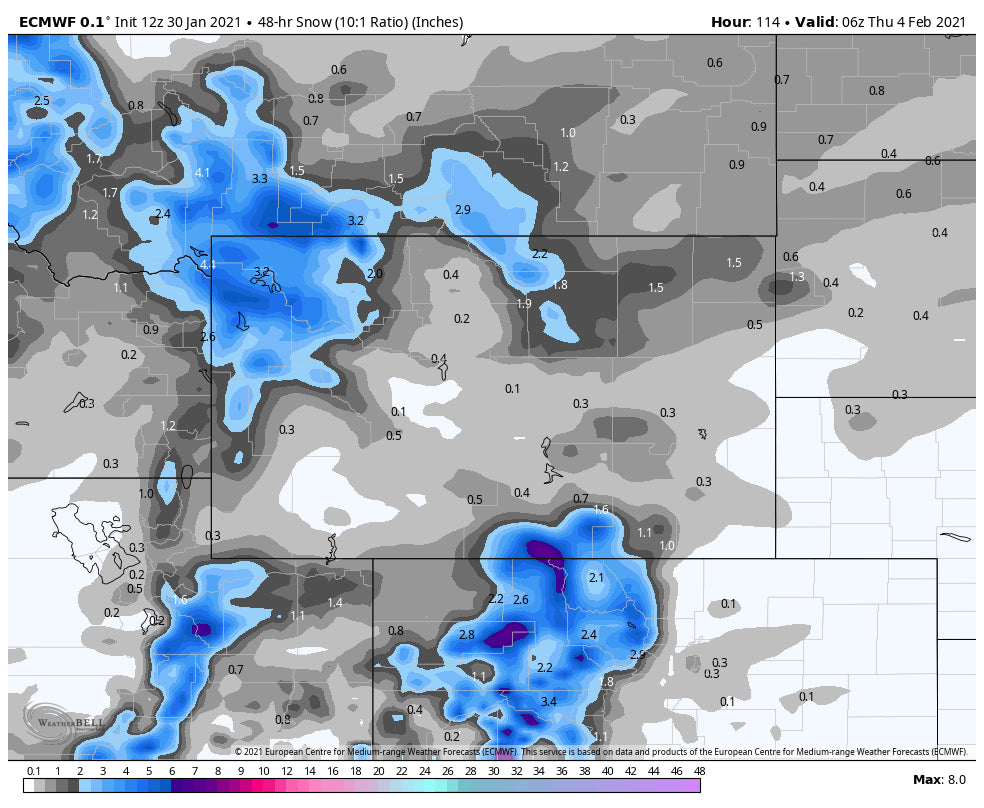
For Colorado and New Mexico optimism exists for a generalized moderate event late next week. Colorado resorts might see 5-10 inches along the I-70 corridor. New Mexico could see higher amounts by Thursday or Friday (Good set up with wind direction and location of the low).
Below: Late next week the southern branch advances over the 4 corners while the northern piece of energy advances east into north-central Colorado.

Photo of the day! Alta Utah Saturday afternoon. Follow @powderchasersteve via Instagram

Please join our custom concierge program if you want to chase powder and get the most accurate powder forecast available. You can also support Powderchasers with a donation here.


